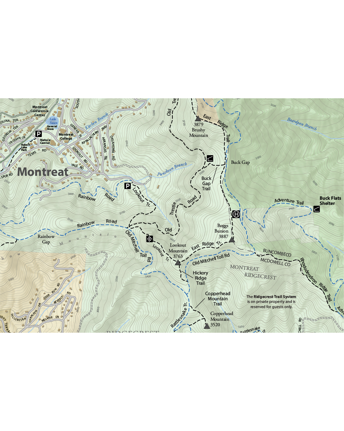
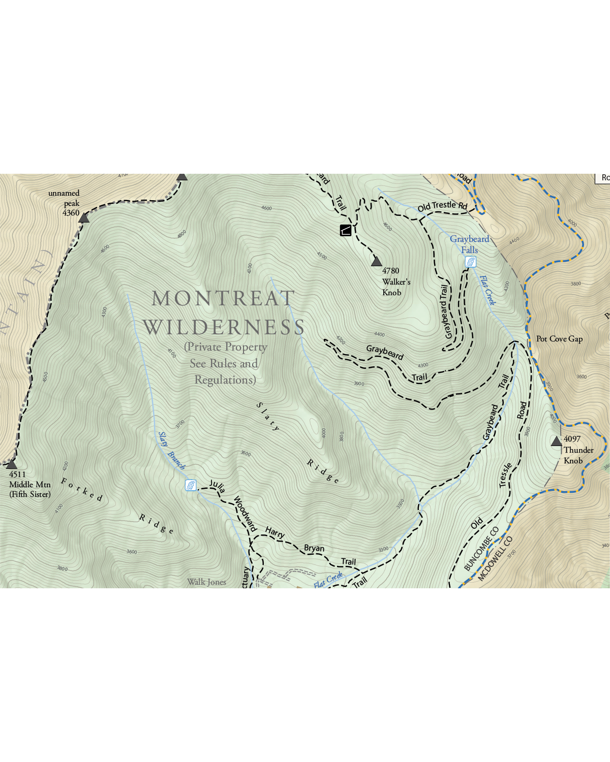
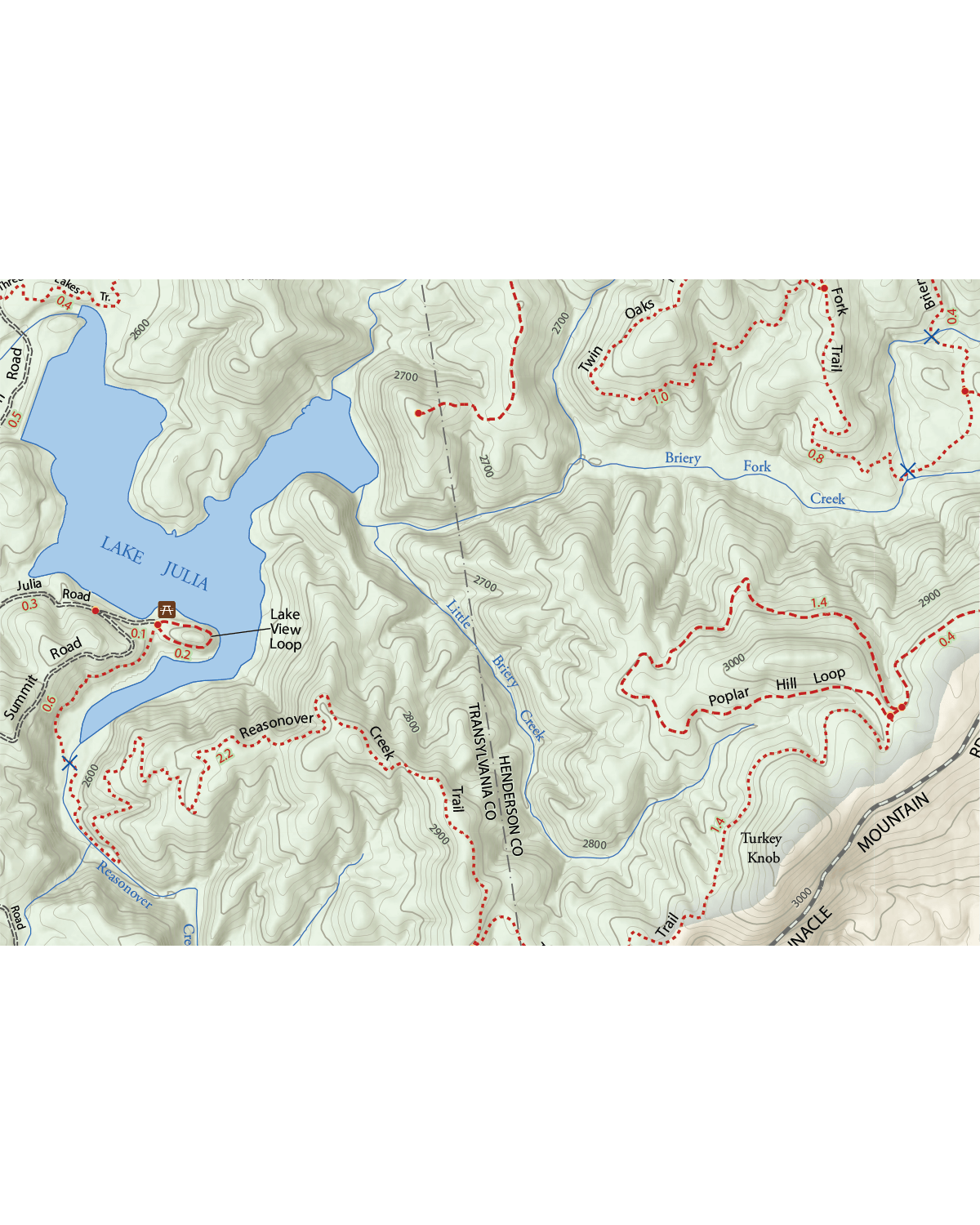
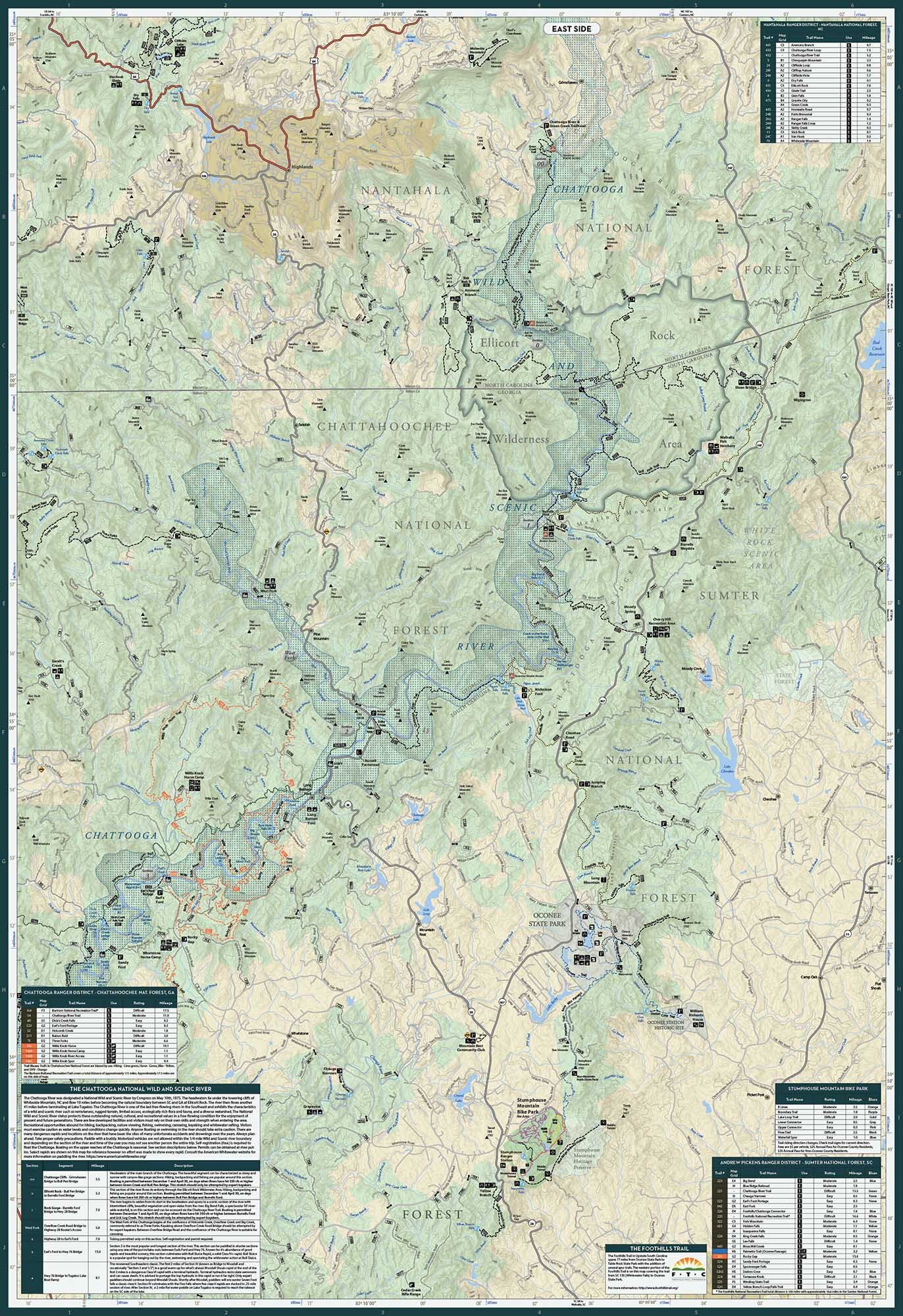
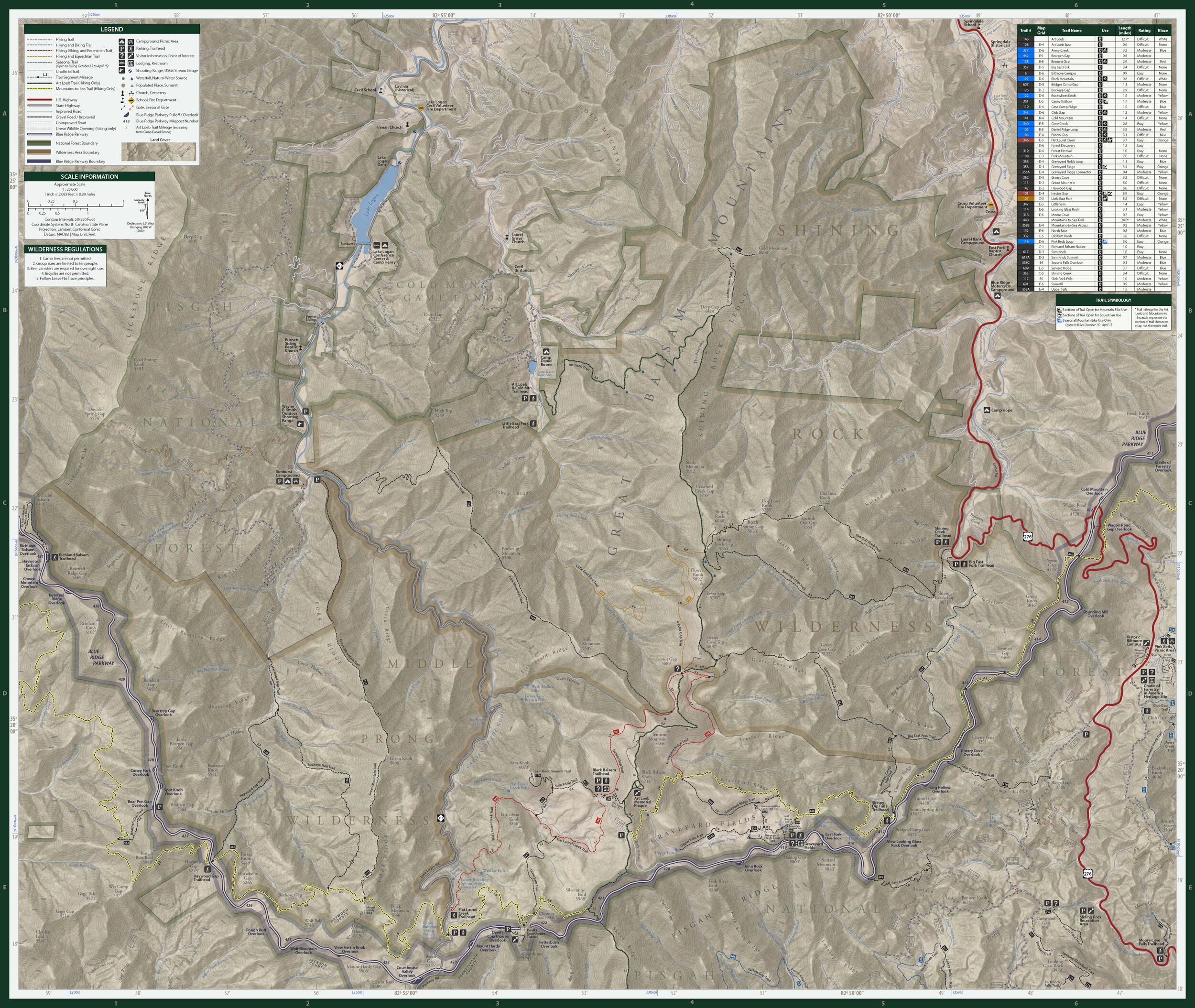
Road cycling maps don’t get much better than this. And road rides don’t get much better than some of those in Transylvania County. This map details the county’s iconic paved routes, with high-traffic roads, food, water and restroom stops clearly labeled so you can plan your epic rides accordingly. And because great routes often know no boundaries, this map includes parts of Henderson, Haywood, and Jackson counties in North Carolina and parts of Upstate South Carolina. So tuck this map in your jersey pocket and go grab some of the beautiful miles in the country.
Technical Stuff
Size: 24” x 30” | 4” x 6” folded
Scale: 1:66,000
1 inch = approximately 1 mile