Custom Cartography & GIS Services
We offer custom mapping and GIS services at an affordable rate. Shoot us a message to discuss your ideas and needs, and read/see below to learn more about what we have done in the past.
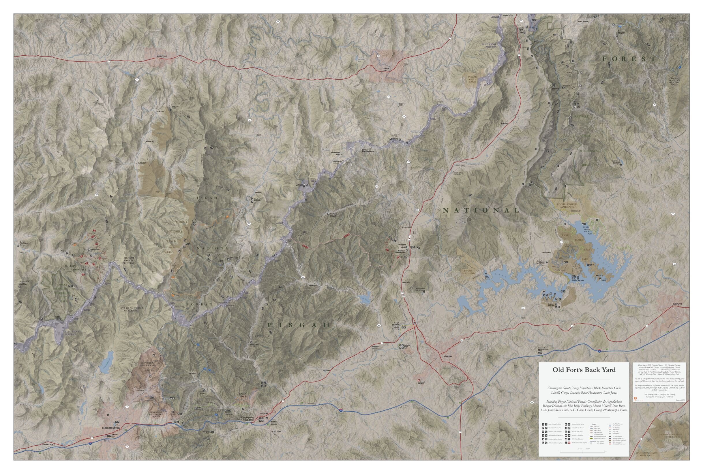
Trail Maps & Adventure Guides
Pisgah Map Company’s roots are in the production of trail guides for several beloved regions of the southern Appalachian Mountains. We craft, maintain and sell maps for the outdoor enthusiast through our website and regional retailers but are always open to creating customized maps for your lands, trails, rivers, etc. in the southeastern USA and beyond.


Conservation & Advocacy Cartography
Our professional backgrounds are in land protection, natural resource management, water quality and recreation and, thus, are knowledgeable on many issues facing the environment. We love supporting advocates, non-profits, land managers and individuals in their conservation planning efforts, public input campaigns, persuasive writing projects, etc.


GIS Analysis & Visualization
Analyzing and visualizing data - environmental, demographic, cultural and economic - is imperative for successful communication and outreach. We are experts in the cartographic display of data via print and web maps but also in the assembly, creation, analysis, and interpretation of spatial data in desktop/mobile GIS and interactive applications.


