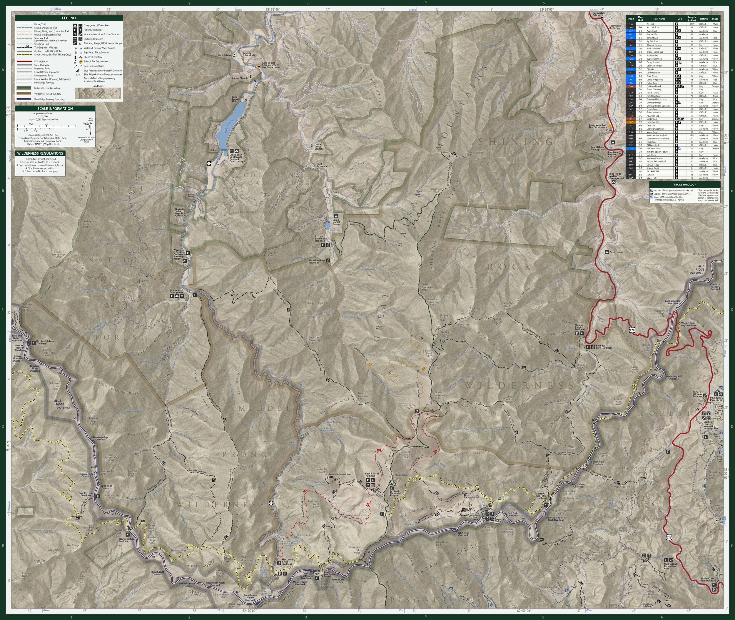
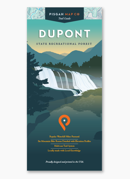
Image 1 of 3
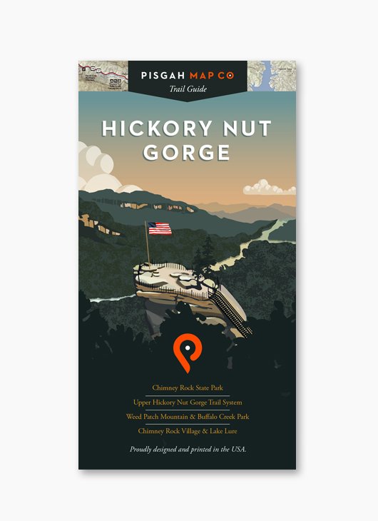
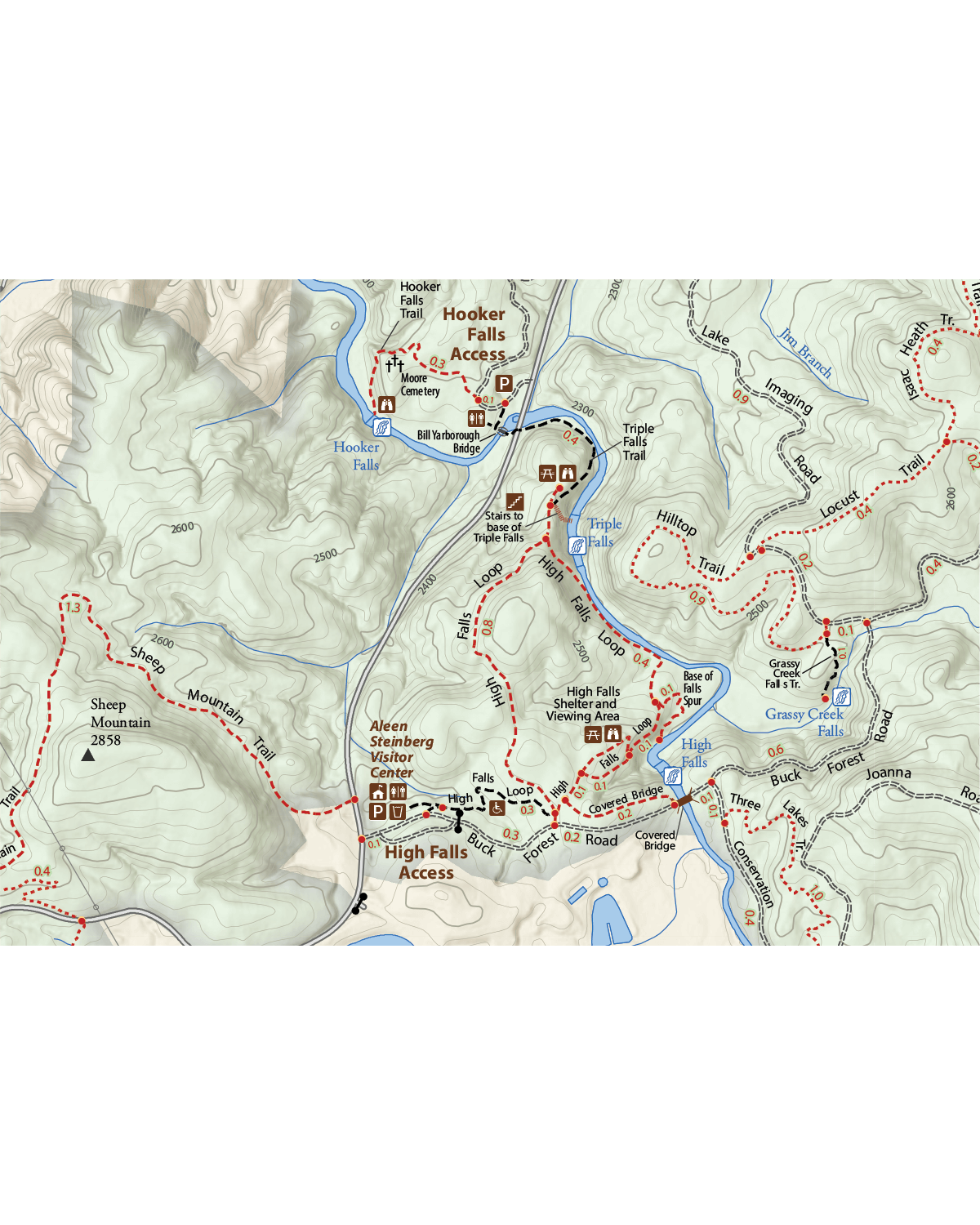
 Image 2 of 3
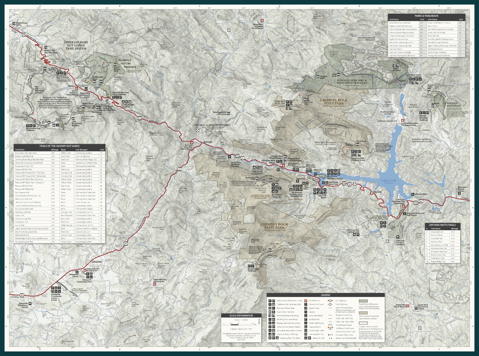
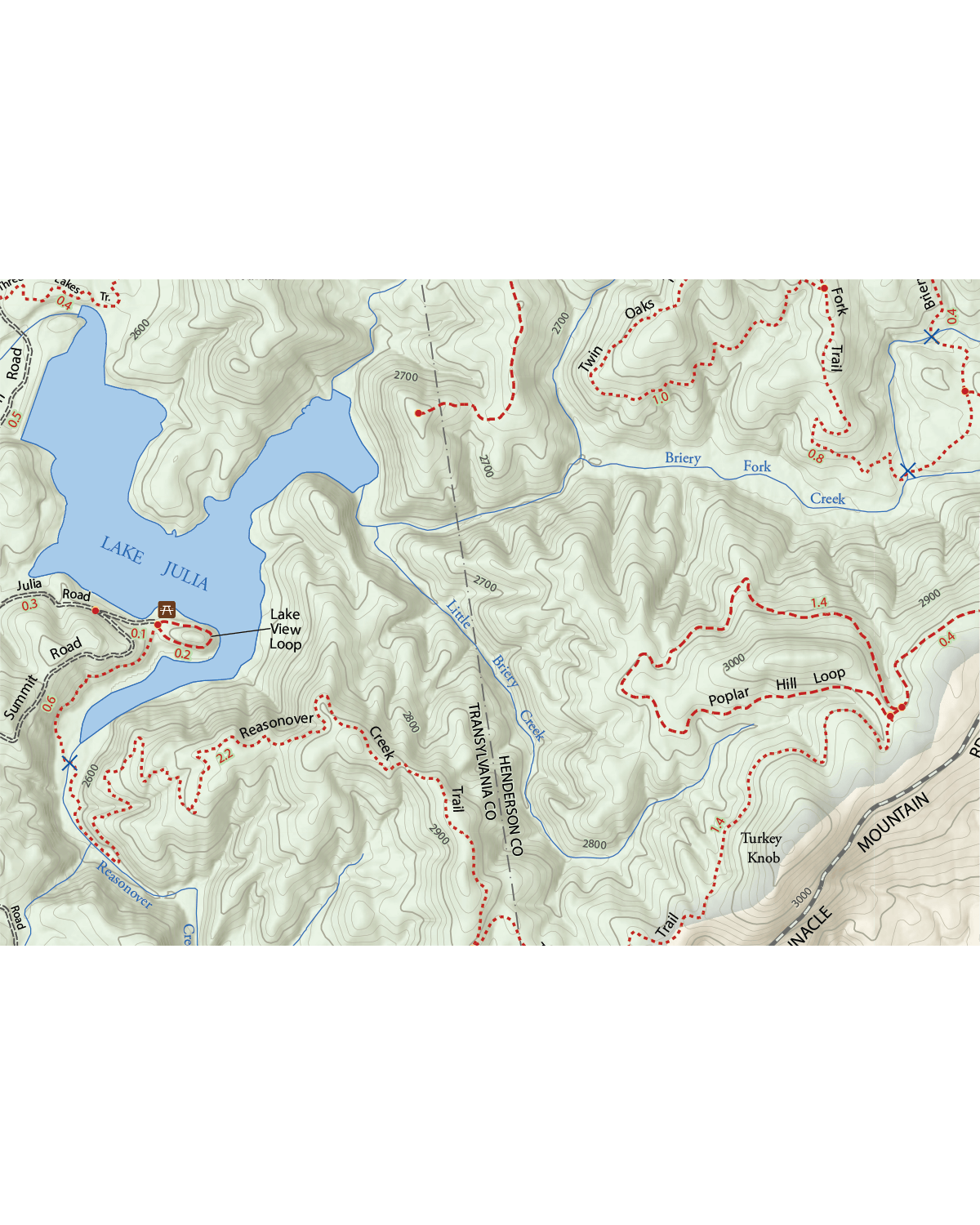
 Image 3 of 3
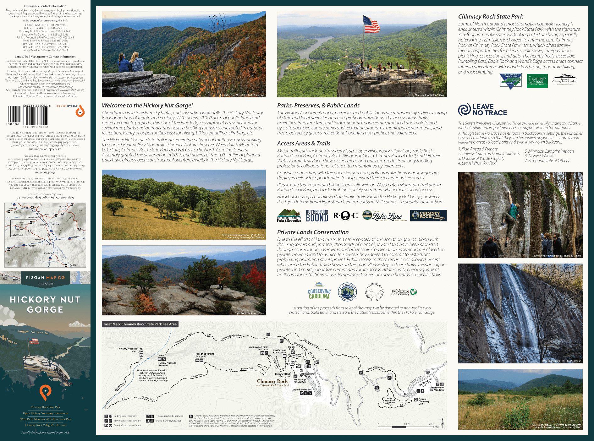
This map leaves no trail untraced in 6 state parks from the Mountain Bridge Wilderness to Whitewater Falls in Upstate South Carolina, and the rugged, remote Gorges State park in Western North Carolina. It’s a nearly nuke-proof guide, blazed for some of the best hiking and biking in the region. But that’s just the beginning. Camping, boating, scenic overlooks and waterfalls are also meticulously marked to make your epic adventure even more epic.
Technical Stuff
Size: 25.75” x 38” | 4” x 9” Folded
Scale: 1:36,000
1 inch = 0.57 miles