Image 1 of 3
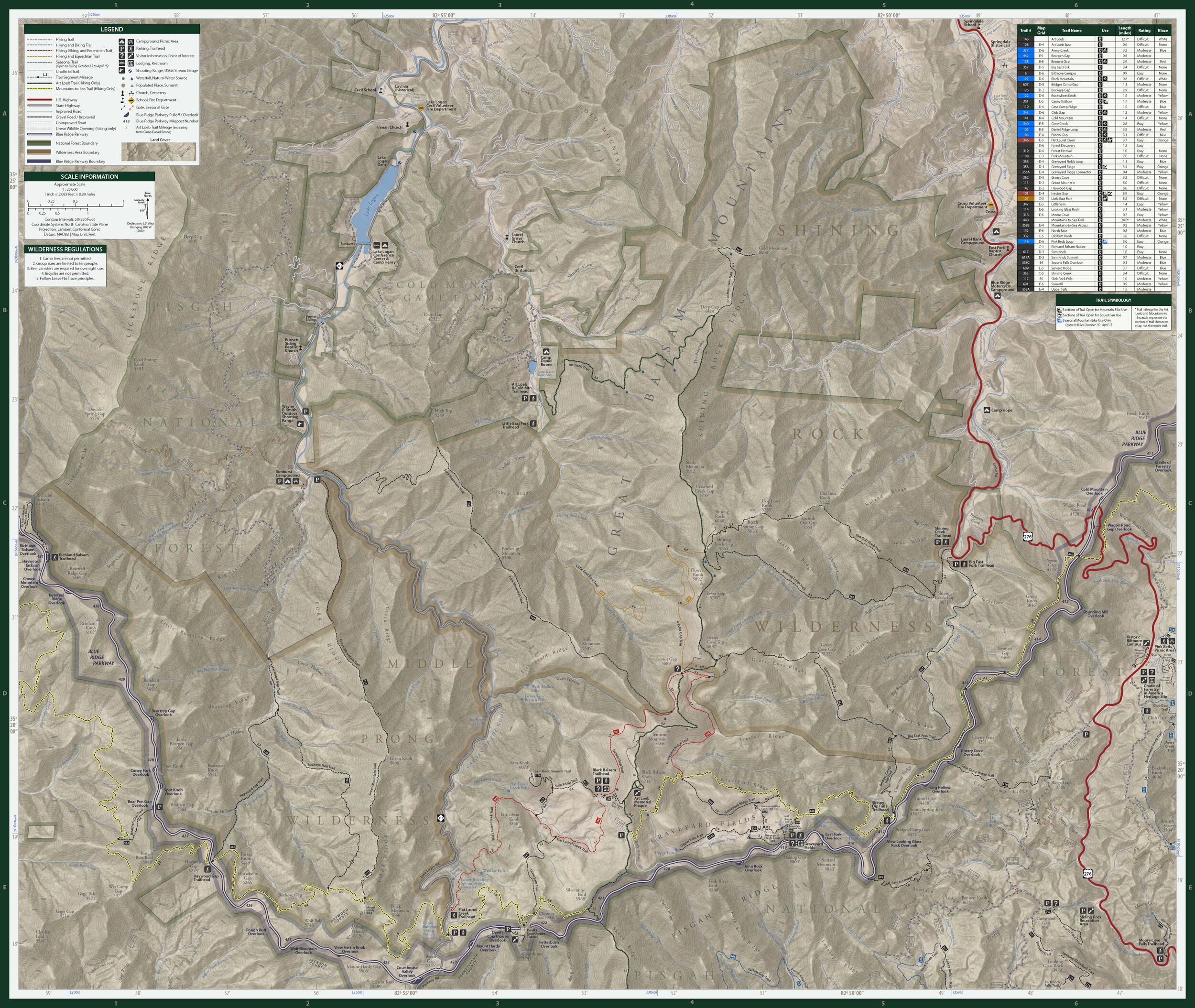 Image 2 of 3
 Image 3 of 3
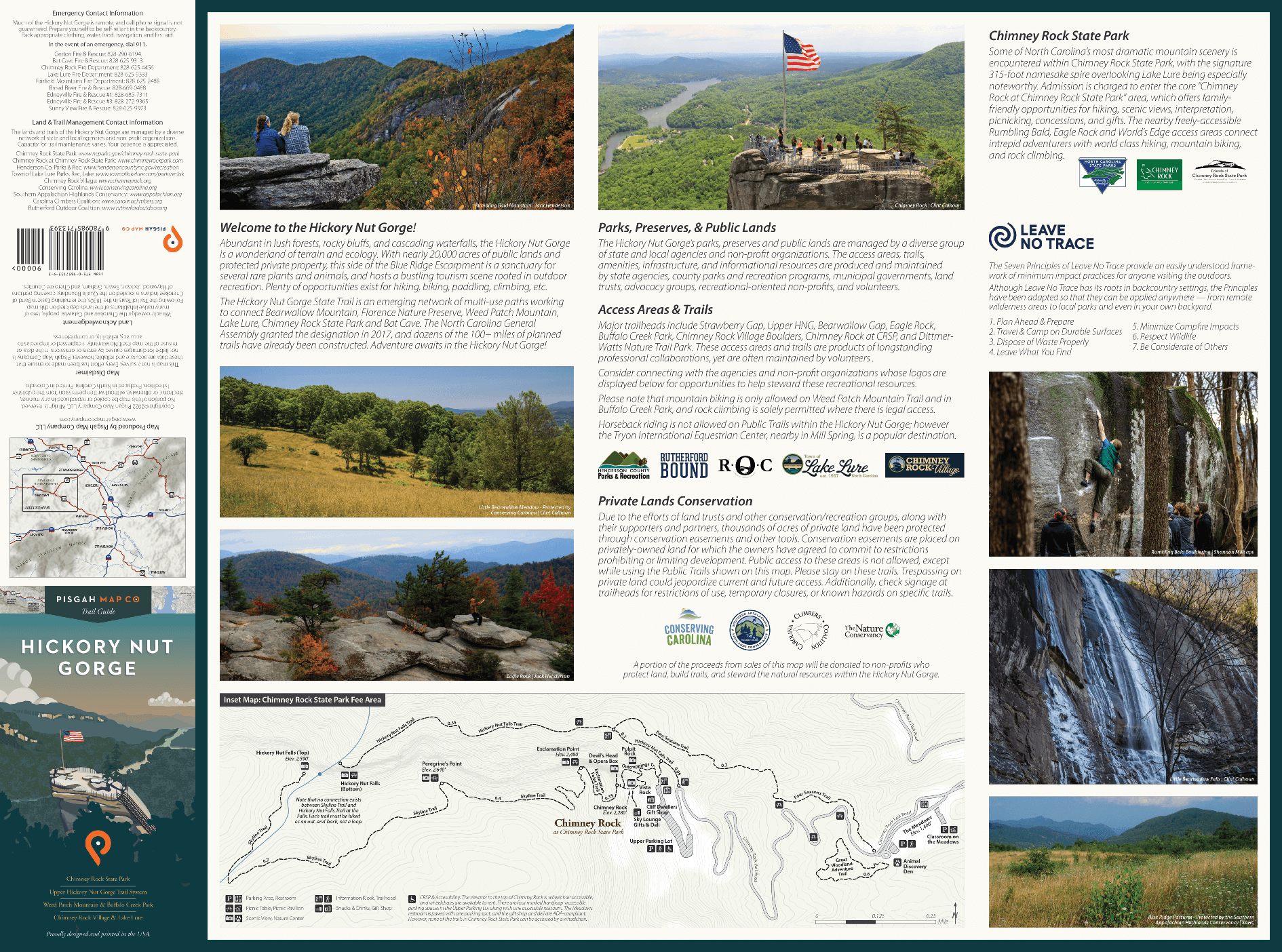
These two U.S. Forest Service-managed landscapes are rich in waterfalls and angling opportunities, holding the headwaters of the Pigeon River.
Endless hiking exists along numerous footpaths, including the Art Loeb Trail beginning at the Daniel Boone Scout Camp. Scenic trails connect the summits of Cold Mountain, Shining Rock, Black Balsam Knob and Tennent Mountain, stunning views treat motorists along the Blue Ridge Parkway, and infinite solitude awaits those who choose to trek into the backcountry.
Expert paddlers enjoy Big East Fork of the Pigeon after a heavy rain, and Ivestor Gap's grassy meadow is perfect for a casual summer picnic.
Shining Rock and Middle Prong Wilderness areas embody the rugged spirit and tenacious ambiance of the southern Appalachians.
Among these frosted peaks and foggy coves, explorers encounter a wild not often found in an otherwise-developed region of the country.