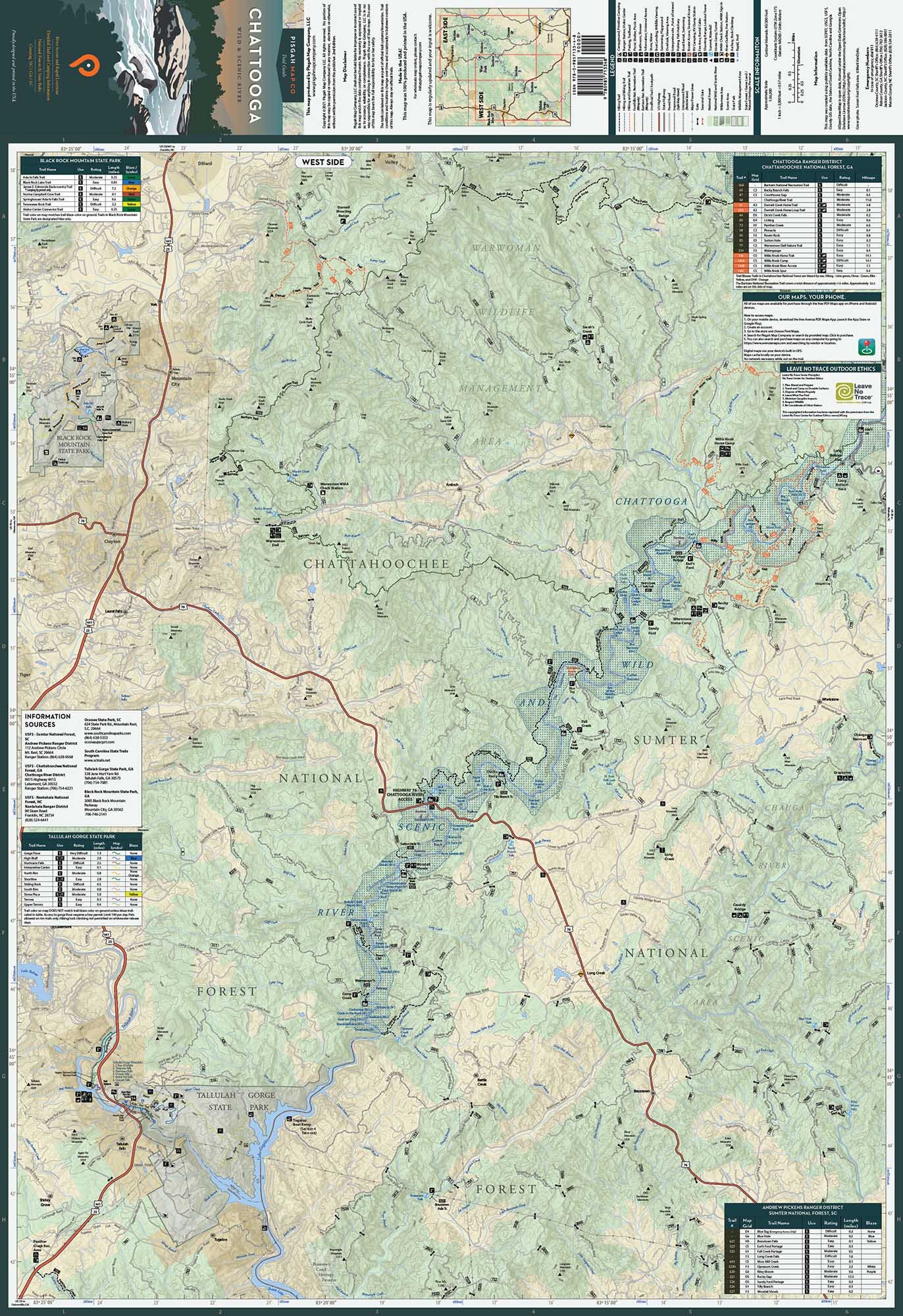
Image 1 of 3
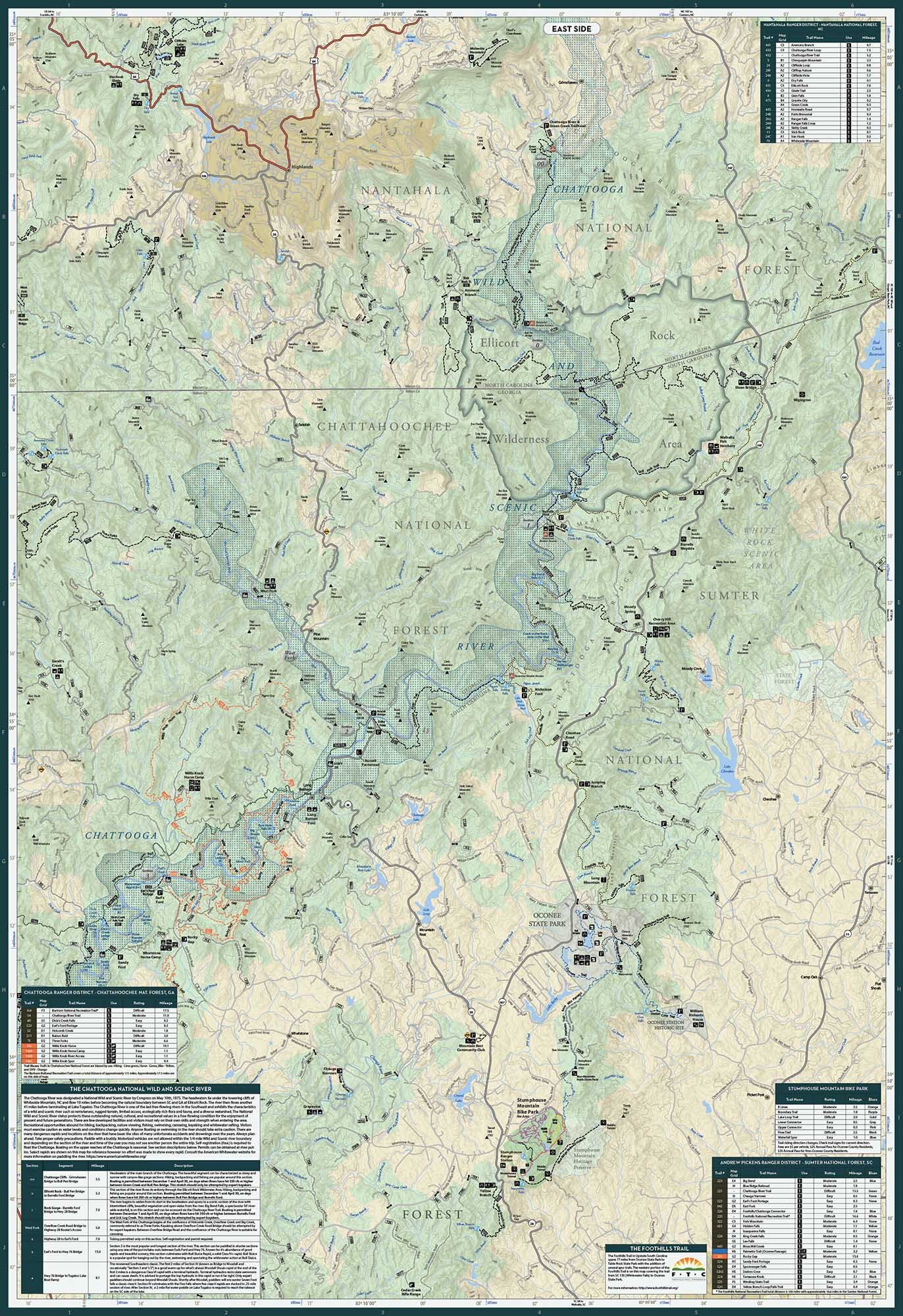
 Image 2 of 3
 Image 3 of 3
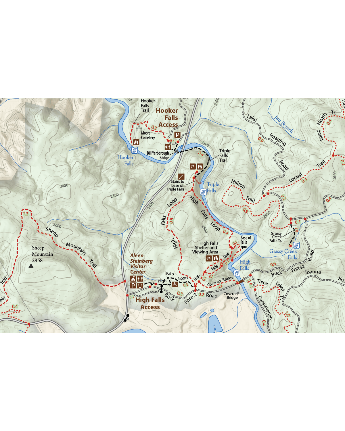
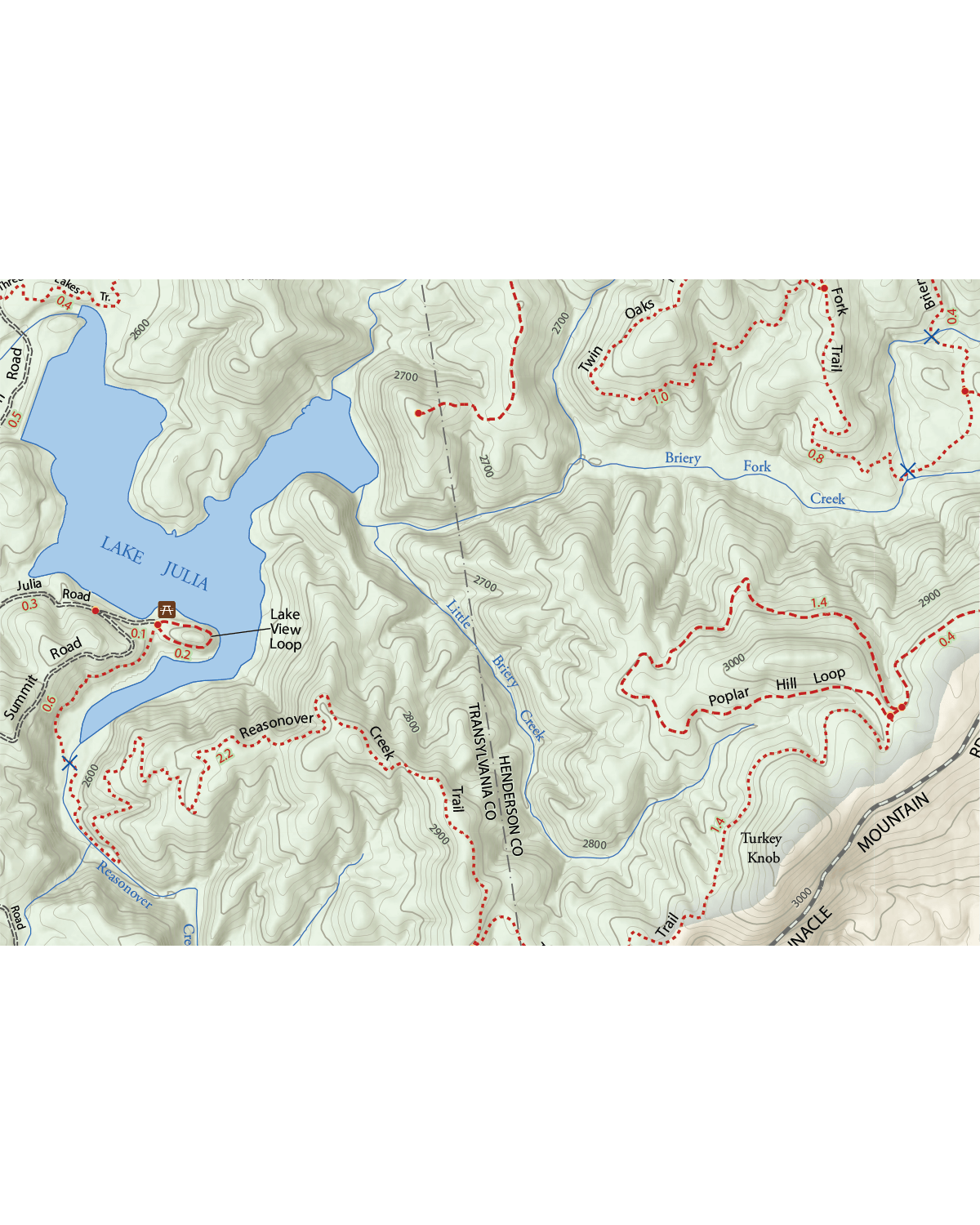
You might want to give yourself a cool trail name. Because one of most beautiful sections of the Appalachian trail cuts across the entire extent of this map from the Smoky Mountains to the Nolichucky River. And, of course, we’ve mapped it in intricate detail...along with every other hiking, biking and horseback riding trail along the North Carolina-Tennessee border. Not to mention waterfalls. Lots of waterfalls.
But our unchecked outdoor obsession wouldn’t let us stop there. This map also has a boatload of river recreation baked into it with indicators for rapids, put-ins and take-outs along the French Broad, Nolichucky and Pigeon Rivers. Basically, if it’s outside it’s probably on the map.
Now, it’s time to stop reading and put this thing to good use. See ya out there.
Appalachian Ranger District / Pisgah National Forest, NC
Unaka Ranger District / Cherokee National Forest, TN
Lamar Alexander Rocky Fork State Park
Martha Sundquist State Forest
Technical Stuff
Size: 26.75” x 39” | 4” x 9” Folded
Scale: 1:63360
1 inch = 1 mile